Obesity by State in the Contiguous United States (2024)
This app was originally developed by Nhan Nguyen. This interactive map visualizes state-level obesity prevalence across the contiguous United States. Users can interact with the map in several ways. Hovering over a state reveals a tooltip displaying the state's name and its corresponding obesity percentage. State names are also displayed directly on the map to improve geographic readability.
Link: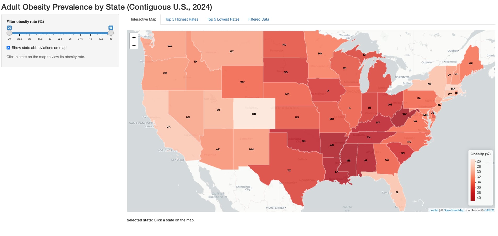
Nhan D Nguyen